
from map info from gutenberg project
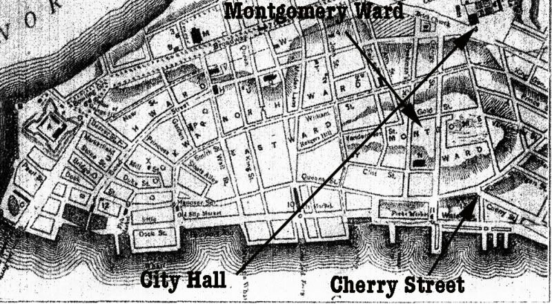
This survey, made in the winter of 1775, shows the city proper as it existed during the Revolutionary War. Places indicated by the lettering are described under the original as follows: A, Fort George. B, Batteries [at the two points of the island]. C, Military Hospital [south of Pearl St.]. D, Secretary's Office [near Fort George]. E, [Not Shown]. F, Soldiers' Barracks [at extreme right]. G, Ship Yards [lower right hand corner]. H, City Hall [Broad and Wall streets, site of present Sub-Treasury building]. I, Exchange. J, K, Jail and Workhouse [both situated on the "intended square or common," now City Hall Square]. L, College [Church and Murray streets; this was King's College, now Columbia University]. M, Trinity Church [the present Trinity was built on 1839-46, though it stands on the site of the old church built in 1696]. N, St. George's Chapel. O, St. Paul's Chapel [built in 1756, the oldest edifice still standing in N.Y.C.]. P to Z, various churches.
I guess Montgomery Ward is named after Richard Montgomery, the war hero and not Aaron Montgomery Ward (February 17, 1844 - December 7, 1913) the businessman notable for the invention of mail order. About Richard Montgomery:
Richard Montgomery (December 2, 1738 – December 31, 1775) was an Irish-born soldier who first served in the British Army. He later became a brigadier-general in the Continental Army during the Revolutionary War and he is most famous for leading the 1775 invasion of Canada.
Montgomery was born and raised in Ireland. In 1754, he enrolled at Trinity College, Dublin, and two years later joined the British army to fight in the French and Indian War. He steadily rose through the ranks, serving in North America and then the Caribbean. After the war he was stationed at Fort Detroit during Pontiac's Rebellion, following which he returned to Britain for health reasons. In 1773, Montgomery returned to the Thirteen Colonies, married Janet Livingston, and began farming.
When the American Revolutionary War broke out, Montgomery took up the Patriot cause, and was elected to the New York Provincial Congress in May 1775. In June 1775, he was commissioned as a Brigadier General in the Continental Army. After Phillip Schuyler became too ill to lead the invasion of Canada, Montgomery took over. He captured Fort St. Johns and then Montreal in November 1775, and then advanced to Quebec City where he joined another force under the command of Benedict Arnold. On December 31, he led an attack on the city, but was killed during the battle. The British found his body and gave it an honorable burial.


2 comments:
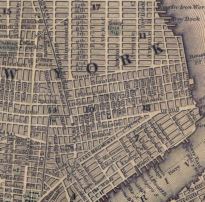
that map is wonderful. I'm a collector of antique documents and am researching a receipt book I recently acquired. It belonged to Allard, Nicholas and John Anthony (John was the father of Allard and Nicholas I believe...) they owned a Tanyard on Vanderwater street in the Montgomery Ward. The receipt book's entries date from june 1789 through one entry dating to 1812. Thank you for posting the map. it's allowed me to get a feeling for exactly where the Tanyard was.
If you would like, you can see some of the receipts from the book here:
http://www.pbase.com/hblairhowell/anthony1789
Post a Comment