Showing posts with label google street view. Show all posts

Sunday, January 9, 2011

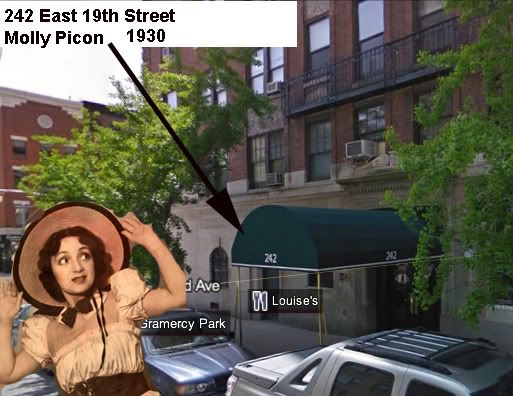
Molly Picon: Not Quite The LES

Molly Picon (Yiddish:מאָלי פּיקאָן) (June 1, 1898–April 5, 1992) was an American star of stage, screen and television, as well as a lyricist. She was first and foremost a star in Yiddish theatre and Film, but as Yiddish theatre faded she began to perform in English-language productions.
Picon was born Małka (Margaret) Opiekun in New York City to Clara and Louis (or Denis) Opiekun (later changed to Picon). Her career began at the age of six in the Yiddish Theatre. In 1912, she debuted at the Arch Street Theatre in New York and became a star of the Second Avenue Yiddish stage.
Opiekun is a Polish language name meaning, "guardian" or "caretaker".
Picon was so popular in the 1920s that many shows had the name Molly in their title. In 1931 she opened the Molly Picon Theatre. She appeared in many films, starting with silent movies. Her earliest film still existing is East and West which deals with the clash of new and old Jewish cultures. Molly plays an American-born daughter who travels with her father back to Galicia in East Central Europe. Real-life husband Jacob Kalich plays one of her Galician relatives from Eastern Europe.
Picon's most famous film, Yidl Mit'n Fidl (1936), was made on location in Poland, and has her wearing male clothing through most of the film. In the film, a girl and her father are forced by poverty to set out on the road as traveling musicians. For her safety, she disguises herself as a boy, which becomes inconvenient when she falls in love with one of the other musicians in the troupe.
Picon made her English language debut on stage in 1940. On Broadway, she starred in Neil Simon's Come Blow Your Horn and the Jerry Herman musical Milk and Honey, both in 1961. In 1966 she quit the disastrous Chu Chem during previews in Philadelphia; the show closed before reaching Broadway.
Her first English speaking role in the movies was the film version of Come Blow Your Horn (1963), and she portrayed Yente, the Matchmaker in the film adaptation of the Broadway hit Fiddler on the Roof in 1971.
In the 1970s, she was featured as a madame named Mrs. Cherry in For Pete's Sake, a film starring another famous Jewish-American actress, Barbra Streisand. She later played a role on television on the soap opera Somerset.

Saturday, April 17, 2010

Grand Street: A Current View

290-294-grand-st                                                            
A previous post with a then and now view of Grand and Eldridge

Tuesday, February 24, 2009

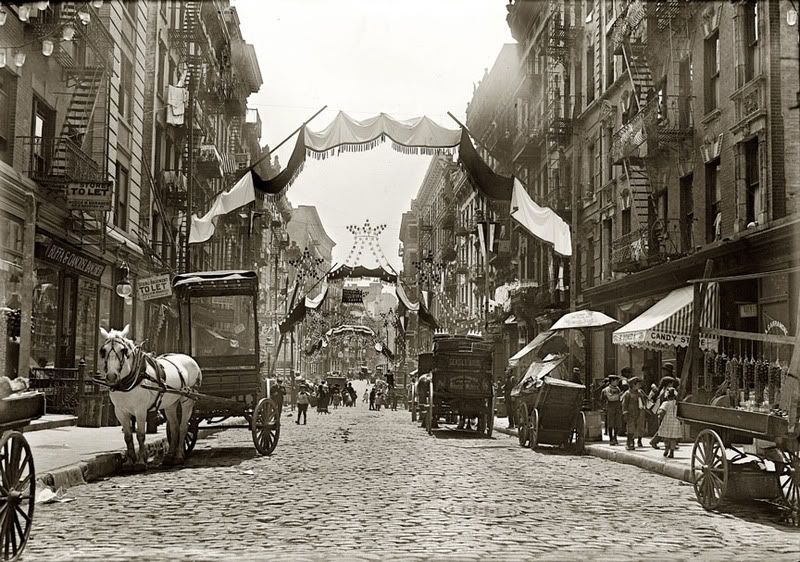
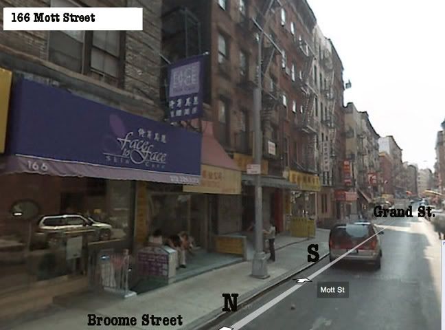
166 Mott Street: Then And Now


from shorpy, go there to see a hi-definition version
Some of the accompanying comments from shorpy's post.
1910. Mott Street in New York's Little Italy, now Chinatown. At the left, 166 Mott (Raffaele Venezia Cafe) is now Face to Face Skin Care. Google Street View. 8x10 glass negative, George Grantham Bain Collection.Time travel, indeed
I recall a time travel novel that had as its basis the fiction that if one were to be so imbued with a time and place and strove to "live" as though you were in that period in a locale that existed now and then, one would wake up some fine day, open the shades and voila, 1910 would be there. How I wish that were true. For now I'll just sit here and revel in each detail of pictures such as this. Thanks again to Dave and all the other posters.
This is time travel in its purest sense, a view into a moment of time frozen forever. Italian cafe, shoemakers, street sweeper, horse carts, vegetable vendor, little children moving around in their home neighborhood. I love it.
The first home I remember was at 1244 15th Avenue in San Francisco. That was 1936. Went past there recently and the street looks exactly the same and it was anything but new when we lived there.
Bet you won't find today's buildings looking exactly the same 100 years from now. You're doing a wonderful job of teaching/reminding us of our history. Thank you.
Wow, I love pictures like this. Not posed at all, just a moment in time caught on film. There are kids playing with something, a guy reading a newspaper, looks like a guy jumping over a broom and every one wearing a hat. The dog, the groceries...perfect. Probably everyone in that picture has already passed on but this one moment in their lives has been captured.
Thanks for the opportunity to see this in a gorgeous and detailed vintage view and in an interesting modern view. I am a big fan of the "Then and Now" type books on different cities, and love to compare shots such as these. While I prefer the 1910 photo (if only filmmakers would get this kind of detail in their period-piece movies!), the Google shot has an interest all its own by virtue of one's being able to manipulate the view! Quite amazing, actually.
Mott Street, 1925 and today
This is a fine neighborhood for Dim Sum, and another site immortalized in popular song lyrics, this time in the 1925 Lorenz Hart song "Manhattan":
And tell me what street
Compares with Mott Street
In July?
Sweet pushcarts gently gliding by.
The great big city's a wondrous toy
Just made for a girl and boy.
We'll turn Manhattan
Into an isle of joy.
Wow! I walked down that street in December when I was visiting NYC (I'm from Brisbane, Australia). I love the black dog on the right. Somehow, I always spot the dogs.
I love that the buildings have changed barely at all. Really interesting to think of the history in those buildings that the people living there now have probably never considered.

Monday, February 23, 2009

Joe Goldstein And Sal Gerage

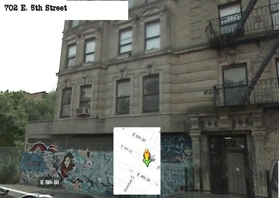
My census search found that Joe Goldstein lived at 702 E. 5th St in 1942. Amazingly, it is one of the few old tenements left on that block

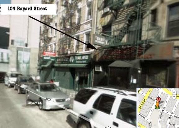
Sal lived at 104 Bayard St, between Mulberry and Baxter.

Sal happened to be a cousin and godfather to KVer Joe Bruno. According to Joe
SAL LIVED AT 104 BAYARD STREET, AS DID HIS MOTHER, MY MOTHER AND 11 OTHER BROTHERS AND SISTERS. IN FACT, THEY WERE ALL BORN AT 104 BAYARD STREET. RIGHT ACROSS FROM THE PARK HOUSE, WHICH WAS AN OUTDOOR DANCE HALL IN THE EARLY 1900'S. THE BAR BELOW THE BUILDING USED TO BE HAPPY'S BAR. NOW IT IS NOW WINNIE'S, A KARAOKE BAR AS WELL AS A HANGOUT FOR SOME OF QUESTIONABLE CHARACTER.

Wednesday, January 28, 2009

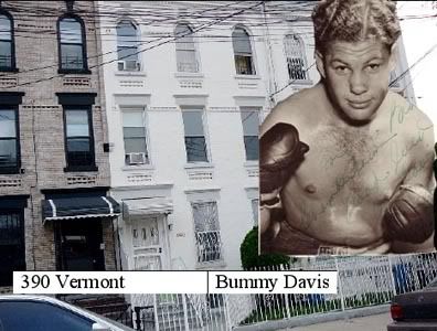
Al "Bummy" Davis: 390 Vermont Ave, Brooklyn


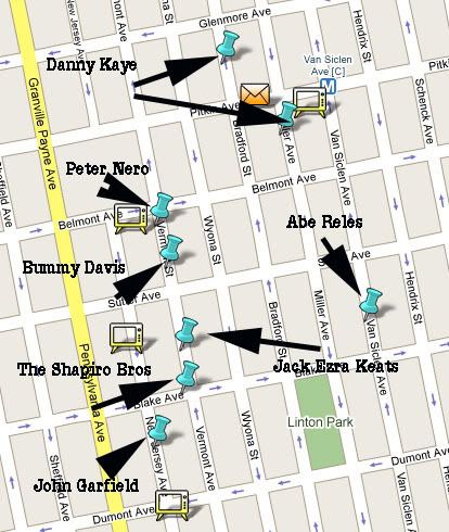
Above, Al's home circa 1930. Below a section from one of my google maps showing the residences of neighboring notables all around the same time as Bummy. The Shapiro brothers were associates of Murder Inc.

Wednesday, July 30, 2008

Searching For Tony 1

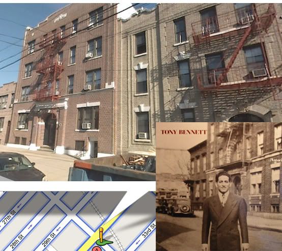
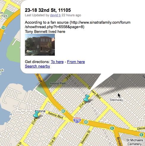
Using Google maps and their "street view" tool I matched up the picture of Tony on the "Perfectly Frank" album cover with an internet source that gave his address as 23-18 32nd Street (as shown in the lower picture). One problem is that Google maps are often inaccurate in their street view photos

Sunday, December 30, 2007

Google Street View: Pike Street South To Cherry Street West


This street view movie goes past the old synagogue on Pike mentioned in the previous post. It continues south until it turns west to go under the Manhattan Bridge arch on Cherry Street.

Wednesday, December 26, 2007

Google Street View: Delancey Street Loop


This starts on Delancey Street and proceeds west to Essex then south to Broome, west on Broome to Clinton and then north back to Delancey. The empty lot on Delancey (approx 129 Delancey) is where Gluckstern's used to be. Marvin and Jerry Kuperstein had their bar mitzvah there. The building at 184 Broome is used as movie production studio by
one of the former St. Elsewhere directors. It used to be a fire house and I believe a primary school in the early 1900's. At 82 Essex you see Seward Park High School and at 84 Essex a building that used to be a Health Dispensary in the early 1900's. Below is a 1930's ? commercial for Gluckstern's from the Yiddish Radio Project. It's sung by the Pincus Sisters

Google Street View: Madison-Market Street Loop


This street view starts on Catherine and Madison Street and proceeds in this way:
West on Madison, North on Oliver, East on East Broadway, South on Market, East on Monroe to Pike Street

Tuesday, December 25, 2007

Google Street View: Catherine Street Loop


This loops from Catherine and Madison westward to Oliver, then north to Chatham Square,
east to Catherine and then south back to Madison.

Google Street View: Chinatown


This is the path we took from our parked car (on Madison, near Oliver) to Hop Kee (at the 00:48 mark) and then afterwards along Mott, past Transfiguration Church, to Canal. Not shown, turn on Canal to the Bowery, turn right on Bowery to Catherine, walk south on Catherine 3 blocks to Madison, turn right on Madison.

Tuesday, November 20, 2007

Knickerbocker Village: Street View 2


Here's another google street view tour of the Knickerbocker Village area. This time taking the circular path beginning with Catherine and Madison and going west. Then the tour goes north on Oliver to Chatham Square and finally east to Catherine and finally south to the tours origin. No sound on this one.

Sunday, November 18, 2007

Knickerbocker Village: Street View


This past summer Google enabled a new street view feature for their google maps (only in selected cities and only on selected streets). I screen captured my navigation of the path of my chosen street view and then added a narration to the movie that the capture created (using snapz pro). For possible use as a literacy aide I added a coordinated text narration using the freeware applications macaw and macaw track manager.