

from wikipedia
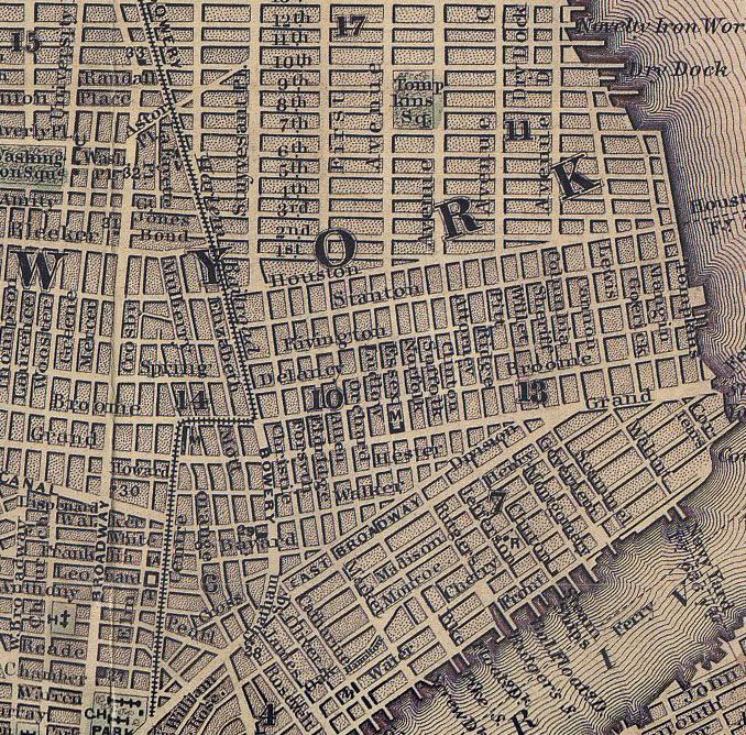
Canal Street is a major street in New York City, crossing lower Manhattan to join New Jersey in the west (via the Holland Tunnel I-78) to Brooklyn in the east (via the Manhattan Bridge). It forms the main spine of Chinatown, and separates it from Little Italy. It also forms the northern boundary of the Tribeca neighborhood and the southern boundary of SoHo.
Canal Street takes its name from an actual canal that was dug in the early 1800s to drain the contaminated and disease-ridden Collect Pond into the Hudson River. The pond was filled in 1811, and Canal Street was completed in 1820 following the angled path the canal had. The elimination of Collect Pond actually made the surrounding land even marshier, as the area had many natural springs that now had nowhere to drain. The historic townhouses and newer tenements that had been built along Canal Street quickly fell into disrepair, and the eastern stretch of Canal Street came within the ambit of the notorious Five Points slum as property values and living conditions plummeted.
from a 1911 historical source
THE COLLECT OR FRESHWATER POND
Lying northeast of the City Hall Park was the pond which has been frequently mentioned in these pages, the Collect, or Freshwater. It had outlets to both the East River and to the Hudson, and it had been proposed several times from very early days to connect the two rivers by a canal across the island, making of the Collect an inland harbor, or basin. Near the North River, the little stream found its way through swamps and meadow land, which were known as Lispenard's Meadows after the owner, Leonard
Lispenard, who had married the daughter of Anthony Rutgers, the original grantee from the city in 1730. Under the terms of his grant, Rutgers was obliged to drain the land; but it was not until 1792 that steps were taken to render the land useful for building purposes. Then followed plan after plan for disposing of the water of the Collect and its outlets; and these were of such diverging character that in the multitude of schemes nothing was done. At Last, in 1808, the proprietors of adjoining lands in despair at the inactivity of the local authorities, petitioned the Legislature for the
appointment of a commission that would adopt and carry out any one plan, however imperfect, rather than that they should continue to be held up in their improvements by so many fluctuating ideas. The result was the laying out of a street one hundred feet wide, through the middle of which was anopen ditch, or canal, with planked sides, which continued to carry off the water of the Collect. Trees were planted along the sides of the ditch and the street became populated; but this took several years to accomplish. The regulating and grading of the streets in the vicinity were going on and the tops of the hills were used in filling in the Collect and the low land of Duggan Street, as it was first called after a tanner of that name who was located at Broadway and Canal Street. Within twenty years afterwards, about 1840, the canal became a covered sewer, which still continues to draw off the water from the springs which fed the ancient Freshwater Pond.


No comments:
Post a Comment