
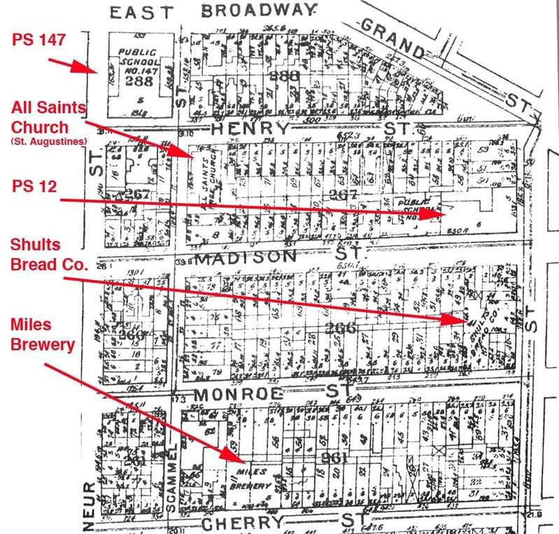
 The map on the right encompasses the area around PS 12 shown here previously on a post about Laguardia visiting the school in 1941
It shows the density of the area at the time. There was only a tiny school yard for the school. There were many industrial plants around, including a bread factory and a brewery. Since there were so many people and so many kids there were schools all over and they were still overcrowded. Visible here is PS 147. Just another block SW and not visible would be PS 31. About 3 blocks NE would be PS 110 as well as PS 34. St. Augustines's Church (called all saint's here), famous in its role in Black History in New York, is visible
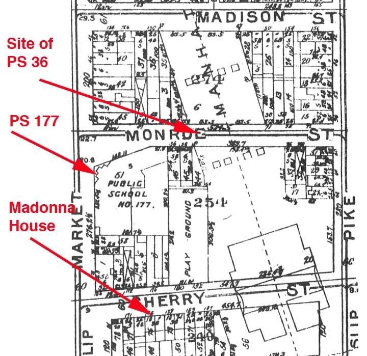 The map of PS 177 shows where PS 36 was located. It was probably demolished in the construction of the Manhattan Bridge in the early 1900's. A previous post about PS 36 mentions its poor condition and its lack of light since it was in the middle of the block. PS 177, constructed I believe in 1903, has more light since it's on the corner. The architect was C.B.J. SNYDER, who was known for the care and beauty he put into school construction.


No comments:
Post a Comment